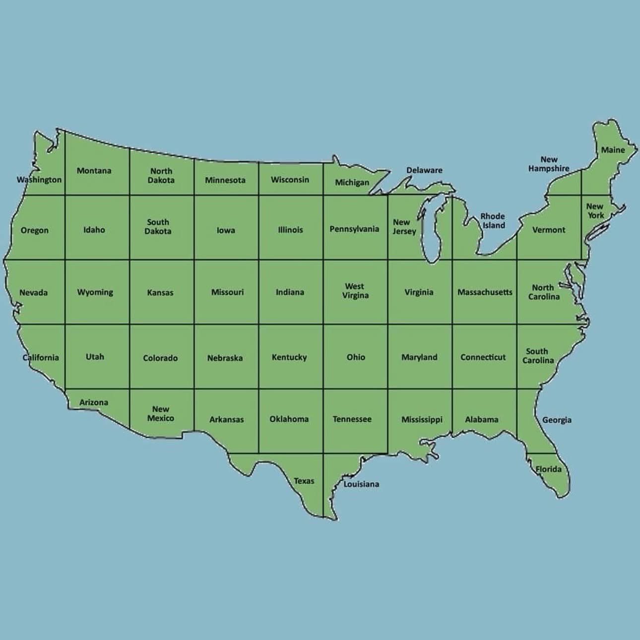
Should've organized them alphabetically too
Cartography Anarchy
A community for Cartographers with nothing left to lose.
Rules:
Don't be awful Lemmy Guidelines Still Apply.
No direct upload images This is hosted on Lemm.ee- to post images, you must use an image upload service like Imgur to post maps.
We are agents of chaos I've created this to be the alternative to the community I used to manage on the website that shalt not be named "mapporncirclejerk"
Live and let die Meme trends happen, so please don't message mods asking to take down maps that are repetitive to a bit.
Reposts Vs. Covers Not all reposts are evil- if someone posts something that has been done years ago, it serves to bring old memes to the new users. I call these meme covers. However it can be done in excess which makes it a repost and spam. Mods will determine if a post is a cover or a repost.
No impersonating mods I can't believe I had to make this rule.
No harassing mods on an appeal We can talk it out, and we will be acting in good faith when making decisions. If you disagree with a removal, you are free to message for clarification or to appeal by giving some added context.
Bans Bans will be set to a maximum of 365 days for humans, and a minimum of 365 years for bots. I believe people can change, so if you are banned for good reason, do know that it is not permanent, it is just a way to say "take time to grow and come back when you are ready".
Much better to organize it by water systems, with some additional divisions for the Mississippi system ans consolidation of smaller systems not seperated by mountain ranges.

Edit: (Image credit: Robert Szucs, Fejetlenfej/Imgur)
What, kind sir, is the source of this beautiful piece of mappery?
I found it with google image search for river map usa, but it was not from the original source, so I did not want to credit them.
No wonder it's called the mighty Mississippi. It's huge!
Some choices were definitely made here.
Delaware.
Where?
Delagone
Uh oh. Looks like someone messed with Texas.
So the states get gradually smaller as you go north? Got it.
Yeah, I would have gone with straight lines, not these weird curved ones.
This somehow feels like a joke about map projections that would make its way into Futurama
That's really high praise, thanks! Made my day.
I moved from Pennsylvania back home to Minnesota a decade ago. Didn't expect it to move back to me.
Lol. California just became The State of Los Angeles
Ah yes Nevada, famous for its coast lines and the bay area
Since it’s not my country I vote for going diagonally
How about squiggles
I see we've forgotten our non-contiguous siblings.
But more to the point, why not just arrange them alphabetically while we're here?
Gerrymanderers hate this one trick...
Ooo, I like this! Now I want to see a map where the area of each state is proportional to its population, but still fitting together in a recognizable way.
I'm not sure which state is furthest from it's original position, but Indiana seems quite far from home.
Delaware is in the U.P.
We are just gonna give South Carolina the outer banks? No. Redraw these lines, pls thnx
South Carolina is Worst Carolina and they deserve nothing but the highway that runs through the state so people can get out quickly.
This hurts.
Maine be like "You guys changed the map?"
Arkansas straight up deleted from existence.
Edit: it’s west of Oklahoma!
Can't believe someone finally won the Toledo War. Really didn't expect it to be Rhode Island
tears up gambling ticket
Ain't no way south Dakota is that far left
There are now two Kansas Cities in Ohio
At first I was pissed thinking I don't want to live in Virginia or Maryland then I was like why the hell is Maryland south of Virginia?
I love this map. It breaks my brain in so many ways!
This is delightful chaotic organization.
texas could honestly be a bit smaller. other states could make better use of that space
[ANGRY PENNSYLVANIAN NOISES]
Georgia and Florida are already kind of like that, culturally speaking.
This is unironically an improvement for Washington and Oregon.
I guess we're just moving New Orleans to Galveston, Biloxi can take over the old location, though personally it feels very threatening to have Mississippi move back to me!
New Jersey moves to Minnesota. That...
Yeah that tracks.
Do any people have to move? Do the governors have to move prior to next election?
Only if they live right on one of the new lines. No one can live on the lines!
I'm not sure what giving NJ a giant flaccid water dong that just barely enters Virginia is supposed to symbolize, but I'm here for it.
I think.
NTY, I do not want to live where Ohio is.
